


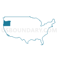
Washington County (Northeast)--Beaverton City (East & Central) & Cedar Mill PUMA, Oregon
About
Outline
--Beaverton+City+(East+%26+Central)+%26+Cedar+Mill+PUMA%2c+Oregon_A280.png)
Summary
| Unique Area Identifier | 193810 |
| Name | Washington County (Northeast)--Beaverton City (East & Central) & Cedar Mill PUMA |
| State | Oregon |
| Area (square miles) | 23.89 |
| Land Area (square miles) | 23.88 |
| Water Area (square miles) | 0.01 |
| % of Land Area | 99.96 |
| % of Water Area | 0.04 |
| Latitude of the Internal Point | 45.49165650 |
| Longtitude of the Internal Point | -122.78917360 |
Maps
--Beaverton+City+(East+%26+Central)+%26+Cedar+Mill+PUMA in Oregon.png)
Graphs
Select a template below for downloading or customizing gragh for Washington County (Northeast)--Beaverton City (East & Central) & Cedar Mill PUMA, Oregon
--Beaverton+City+(East+%26+Central)+%26+Cedar+Mill+PUMA%2c+Oregon_T0.png)
--Beaverton+City+(East+%26+Central)+%26+Cedar+Mill+PUMA%2c+Oregon_T1.png)
--Beaverton+City+(East+%26+Central)+%26+Cedar+Mill+PUMA%2c+Oregon_T2.png)
--Beaverton+City+(East+%26+Central)+%26+Cedar+Mill+PUMA%2c+Oregon_T3.png)
--Beaverton+City+(East+%26+Central)+%26+Cedar+Mill+PUMA%2c+Oregon_T4.png)
--Beaverton+City+(East+%26+Central)+%26+Cedar+Mill+PUMA%2c+Oregon_T5.png)
--Beaverton+City+(East+%26+Central)+%26+Cedar+Mill+PUMA%2c+Oregon_T6.png)
--Beaverton+City+(East+%26+Central)+%26+Cedar+Mill+PUMA%2c+Oregon_T7.png)
--Beaverton+City+(East+%26+Central)+%26+Cedar+Mill+PUMA%2c+Oregon.png)
Neighbors
Neighoring Public Use Microdata Area (by Name) Neighboring Public Use Microdata Area on the Map
- Portland City (Northwest & Southwest) PUMA, OR
- Washington County (Central)--Beaverton City (West) & Aloha PUMA, OR
- Washington County (Southeast)--Tigard, Tualatin & Sherwood Cities PUMA, OR
- Washington County (West)--Forest Grove, Cornelius Cities, Bethany & Oak Hills PUMA, OR
Top 10 Neighboring County (by Population) Neighboring County on the Map
Top 10 Neighboring County Subdivision (by Population) Neighboring County Subdivision on the Map
- Beaverton-Hillsboro CCD, Washington County, OR (404,973)
- Portland West CCD, Multnomah County, OR (125,084)
- Rockcreek CCD, Washington County, OR (69,001)
Top 10 Neighboring Place (by Population) Neighboring Place on the Map
- Portland city, OR (583,776)
- Beaverton city, OR (89,803)
- Tigard city, OR (48,035)
- Bethany CDP, OR (20,646)
- Cedar Mill CDP, OR (14,546)
- Cedar Hills CDP, OR (8,300)
- West Haven-Sylvan CDP, OR (8,001)
- Garden Home-Whitford CDP, OR (6,674)
- West Slope CDP, OR (6,554)
- Raleigh Hills CDP, OR (5,896)
Top 10 Neighboring Unified School District (by Population) Neighboring Unified School District on the Map
- Portland School District 1J, OR (459,982)
- Beaverton School District 48J, OR (255,082)
- Tigard-Tualatin School District 23J, OR (78,274)
Top 10 Neighboring State Legislative District Lower Chamber (by Population) Neighboring State Legislative District Lower Chamber on the Map
- State House District 33, OR (79,509)
- State House District 35, OR (65,721)
- State House District 34, OR (65,504)
- State House District 28, OR (64,020)
- State House District 36, OR (63,722)
- State House District 27, OR (62,120)
Top 10 Neighboring State Legislative District Upper Chamber (by Population) Neighboring State Legislative District Upper Chamber on the Map
- State Senate District 17, OR (145,013)
- State Senate District 18, OR (129,443)
- State Senate District 14, OR (126,140)
Top 10 Neighboring 111th Congressional District (by Population) Neighboring 111th Congressional District on the Map
- Congressional District 1, OR (802,570)
- Congressional District 3, OR (762,155)
- Congressional District 5, OR (757,128)
Top 10 Neighboring Census Tract (by Population) Neighboring Census Tract on the Map
- Census Tract 315.13, Washington County, OR (11,399)
- Census Tract 70, Multnomah County, OR (8,181)
- Census Tract 319.10, Washington County, OR (7,993)
- Census Tract 301.01, Washington County, OR (7,544)
- Census Tract 315.08, Washington County, OR (7,507)
- Census Tract 310.03, Washington County, OR (7,390)
- Census Tract 313, Washington County, OR (7,201)
- Census Tract 316.11, Washington County, OR (7,147)
- Census Tract 312, Washington County, OR (7,137)
- Census Tract 310.04, Washington County, OR (6,967)
Top 10 Neighboring 5-Digit ZIP Code Tabulation Area (by Population) Neighboring 5-Digit ZIP Code Tabulation Area on the Map
- 97007, OR (66,954)
- 97006, OR (63,036)
- 97229, OR (58,217)
- 97223, OR (46,699)
- 97219, OR (38,709)
- 97008, OR (28,969)
- 97005, OR (24,906)
- 97225, OR (24,176)
- 97221, OR (11,630)
- 97210, OR (10,887)